Northern Illinois Field Station-Elgin
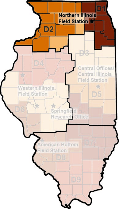 The Northern Illinois Field Station (NIFS) crew stationed in Elgin conducts Phase I reconnaissance and Phase II testing and excavation of sites in IDOT Districts 1 and 2 and Bureau and DeKalb Counties in District 3.
Dr. Clare Tolmie, Field Station Coordinator
21 N. Union St.
Elgin, IL 60123
(224) 281-4730
Johns Mound Group (11WO3): Detailed Mapping and Threat Assessments
(IDOT Seq. No. 16317, ISAS Log No. 16152), District 2, funded by IDOT
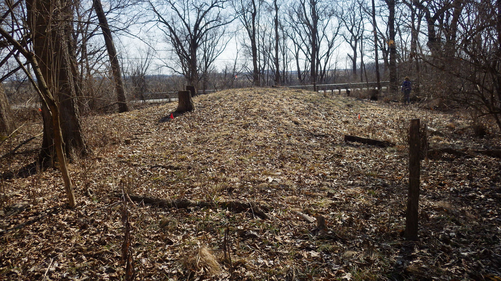 The 19.8-acre Johns Mound Group (11WO3) is situated on a high terrace on the west side of the Rock River, north of the confluence of the Kishwaukee and Rock Rivers and south of Rockford. A total of 22 earthen mounds (1 panther, 1 panther or turtle, 6 linear, 12 conical, 2 indeterminate) and 2 large borrows are present on the site— dating to the Middle and Late Woodland periods. Approximately 2.3 acres of the site lie within the present IDOT right-of-way, and present and future roadwork along Illinois Route 2 has the potential to impact the mound group.
Current estimates are that only 2 of the 27 effigy mounds once present in Winnebago County still remain— a turtle mound in Rockford’s Beattie Park (11WO1), and the panther mound and panther/turtle mound in the Johns Mound Group. The Johns Mound Group is currently protected under a number of state and federal. Participants involved in preservation of the site include the Smeja Family Foundation, the Illinois Nature Preserves Commission, the Illinois Department of Natural Resources, the Illinois Historic Preservation Agency, and the Illinois Department of Transportation.
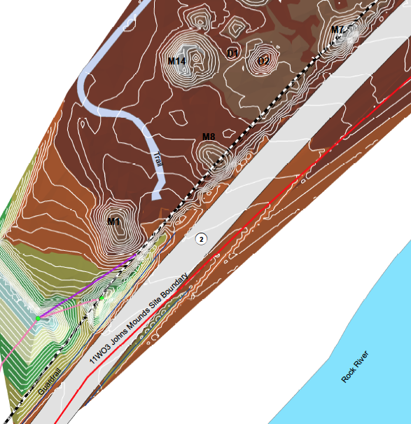 In the spring of 2017, to aid in the preservation of this significant archaeological resource, NIFS staff completed detailed topographic mapping of a 40 to 60-meter-wide corridor along the entire eastern edge of the Johns Mound Group, extending from the IL Route 2 centerline northwestward into the site area, capturing 13 mounds and the 2 borrow depressions. A reevaluation of the current condition and threats to all 24 cultural features present (22 mounds and 2 depressions) was completed, confirming that portions of not only the panther mound but also four additional mounds are present within the IDOT right-of-way. Working together, ISAS, IDOT, IDNR, INPC, and the Smeja Family Foundation are developing long term strategies for the monitoring and preservation of this unique archaeological site.
Posted 11 May 2017
Return to top
Civilian Conservation Corps “Camp Skokie” and WWII German POW “Camp Glenview”
Blue Star Memorial Woods, Forest Preserves of Cook County
(FPCC Log No. 115a; ISAS Log No. not available), funded by FPCC
In the closing years of World War II, German prisoners of war were brought to the United States and held within a large network of camps located throughout the country. To alleviate space in the crowded POW camp system, and to get prisoners closer to those industries worst hit by the labor shortages caused by the war, a series of smaller branch camps was established. In Chicago, at least four such branch camps were in operation, holding several hundred German soldiers each. Three of these camps utilized converted CCC camps, on properties all located today in the Forest Preserves of Cook County. While the superstructures have long since been dismantled, and the woods left to reclaim the land, remnants of these camps are still present. One POW camp in particular, Camp Glenview (which housed nearly 400 prisoners at one point), utilized the former CCC Camp Skokie facility. Camp Skokie was the largest of the CCC camps established within the United States, at one time housing over 2,000 men responsible for the construction of the Skokie Lagoons just north of Chicago. Here, the remains of roadways, walkways, foundations, drainage systems, middens, landscaping, and at least one guard tower still survive from the CCC and POW camp occupations.
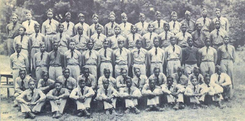
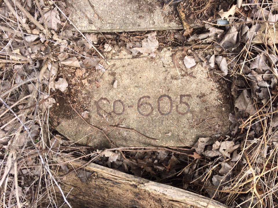
As part of our ongoing contract with the Forest Preserves of Cook County, and together with researchers James Meierhoff from the University of Illinois at Chicago and Joseph Wheeler from the Midewin National Tallgrass Prairie (National Forest Service), NIFS staff have given public tours of the property, are gathering archival documents, working with local residents, and documenting the archaeological components associated with both the ca. 1930s CCC camp and the ca. 1944 POW camp. A recent discovery, made in the spring of 2017, includes exposure of the concrete stoop and foundation of the CCC barracks for Company 605 – one of two African American companies housed at Camp Skokie.
Posted 11 May 2017
Return to top
Illinois Route 2 Phase I Survey, Ogle County
(IDOT Seq. No. 19733, ISAS Log No. 16135), District 2, funded by IDOT
In the fall of 2016, NIFS staff conducted limited Phase I field survey and a full literature search in advance of a proposed road resurfacing and bridge repair project along a 9.6-mile-long portion of Illinois Route 2, parallel to the Rock River in Ogle County. The project area contains 25 previously recorded sites representing all prehistoric and historic time periods from Late Paleoindian onward, indicating continuous use of this landscape from 9,000 B.C. through the Historic Native American and Historic Euroamerican periods.
Eight of the 25 previously recorded sites (11OG183, 11OG185, 11OG188, 11OG243, 11OG249, 11OG250, 11OG262, and 11OG265) may be eligible for National Register of Historic Places listing. One site in particular, 11OG188 (the Andrus Mound and Village Site), may also warrant consideration under Criterion B for its association with a person significant in the history of the region. By 1872, the land containing 11OG188 was owned by Leonard Andrus. Andrus is credited as the first settler and founder of Grand Detour in 1834; the original petitioner for the Byron Dixon Highway which is today IL 2; the first school commissioner in Ogle County; responsible for naming the city of Byron; the initial business partner with John Deere of “The Grand de Tour Plow Works” founded 1841; and was a founding member of several enterprises in Grand Detour including the mail line, grist mill, and public school. Previous investigations at 11OG188 (conducted outside the present IDOT project area) indicate that the prehistoric component of 11OG188 represents potentially one of the most complete records of habitation in the Rock River area. Diagnostic artifacts indicate land use as early as the Paleoindian period, significant ritual activity in the Middle Woodland periods, and intense domestic activity during the Late Woodland period. The historic component of 11OG188 contains well-preserved historic features and cultural deposits potentially associated with the Leonard Andrus occupation.
Three sites (11OG188, 11OG243, and 11OG265) contain prehistoric mounds and burial site components protected under Human Skeletal Remains Protection Act – 2 of these 3 sites contain mounds located within or at the edge of the IDOT right-of-way. However, the proposed IDOT resurfacing project is quite limited in scope and, as currently designed, will include little to no actual ground disturbance within the right-of-way. As a result of field survey and archival investigations, NIFS concluded there will be no adverse effect to any mounds nor to any of the remaining previously recorded sites present within the project area. Project clearance has been recommended.
Posted 11 May 2017
Return to top
Greencorps Chicago and Youth Outdoor Ambassador Internships, Thatcher Woods Preserve, Cook County
(FPDCC Log No. 87c, ISAS Log No. not available), funded by FPDCC and Greencorps Chicago
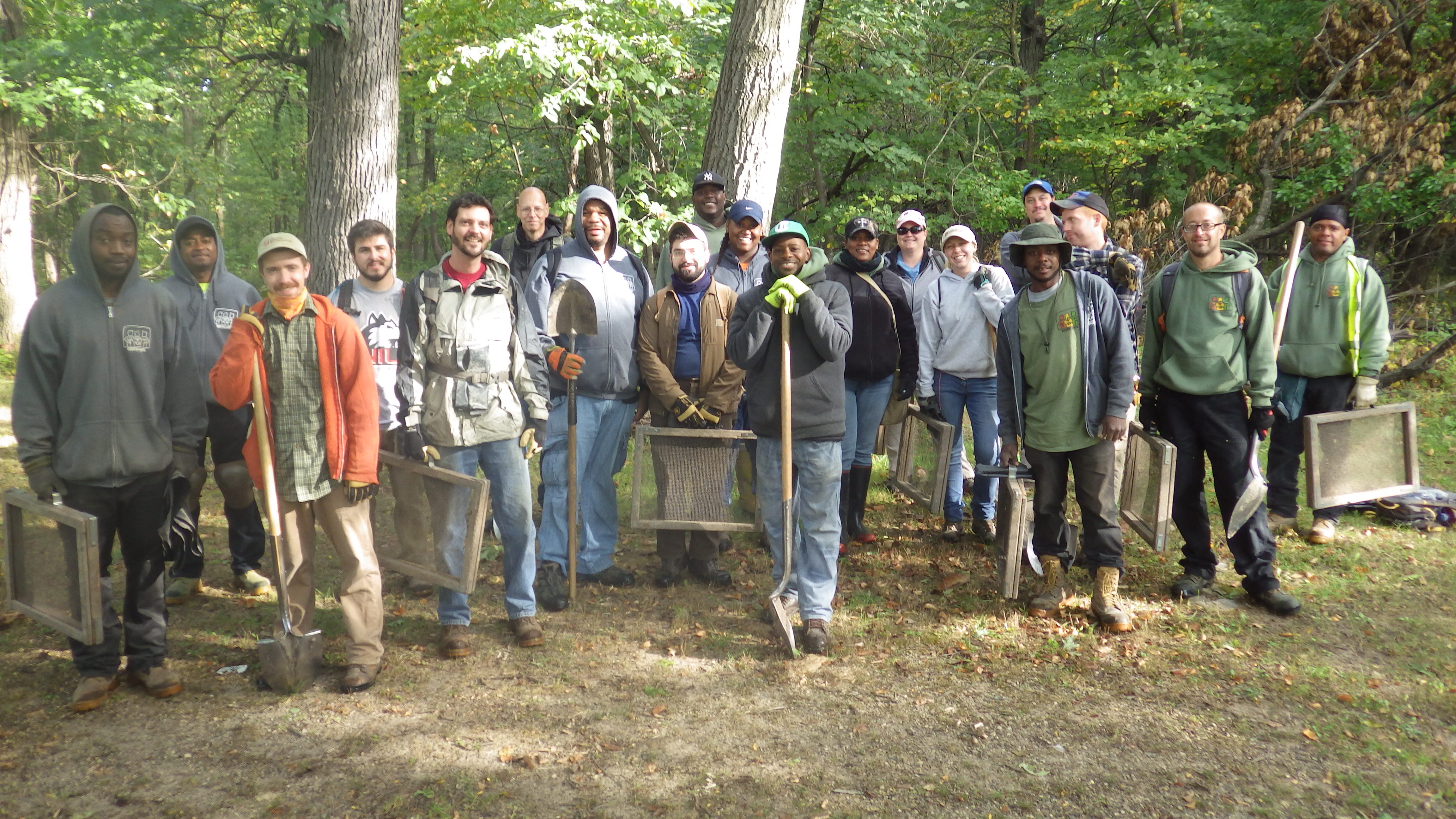
Intermittently, from early July through the end of September 2016, NIFS staff completed archaeological survey of over 180 acres of land located along the Des Plaines River in the Thatcher Woods Preserve, a part of the Forest Preserve District of Cook County (FPDCC). Much of the work was completed in partnership with Greencorps Chicago and the FPDCC’s Youth Outdoor Ambassador programs with NIFS providing internships for Chicago area youth to help them gain skills in cultural resource management careers. Interns worked one-on-one in the field with professional NIFS staff learning archaeological field survey methods, artifact identification, and site documentation and mapping. This collaborative partnership helped identify seventeen new archaeological sites and revisit four previously recorded archaeological sites.
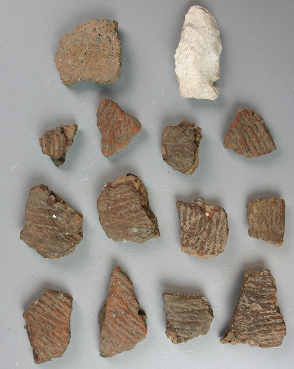 Such a dense concentration of sites located along the east terrace of the Des Plaines River yielding so many lithic and ceramic artifacts strongly suggests that the landscape was used from the Middle Archaic through Late Woodland periods. Importantly, several of the sites also have conical mounds; with one site containing one of the last remaining effigy mounds in northeastern Illinois— a serpent devouring an egg.
Another site represents the “Lost Village of Edgewater,” an abandoned town site occupied from the late 1890s through the 1930s. Now reclaimed by dense woods, the site still has visible evidence of raised roadbeds and house foundations. As a result, FPDCC land managers will incorporate archaeological site information within their long-term resource preservation plans for the Thatcher Woods parcel.
Posted on 14 November 2016.
Return to top
Gilmer Road Realignment Project
(IDOT Seq. No. 18206, ISAS Log No. 13148), District 1, funded by IDOT
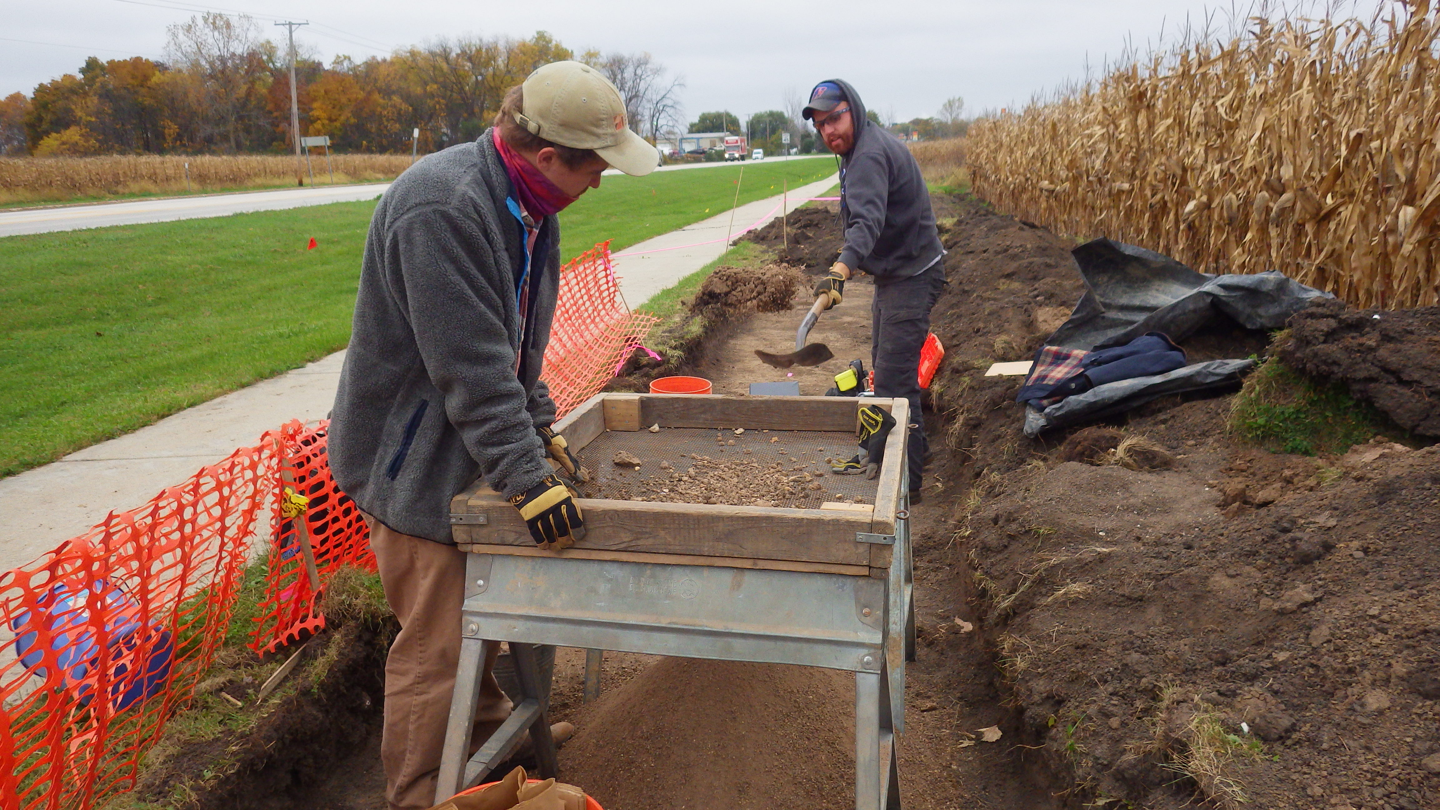
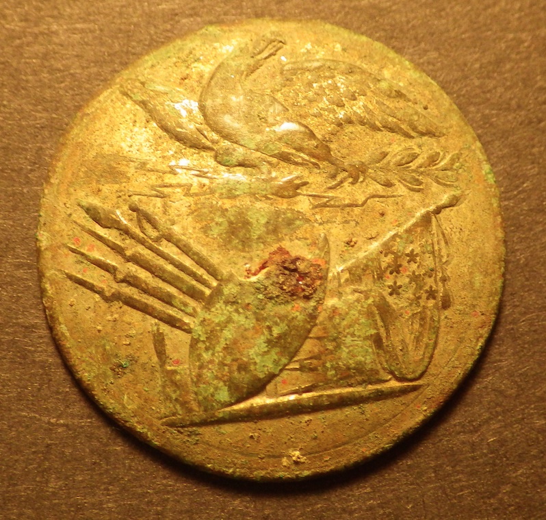 In the fall of 2016, NIFS completed test excavations on a portion of a pre-Civil War era site (11L752) initially found in 2014 during survey for the Gilmer Road Realignment project in Lake County. The site is located along Gilmer Road, southeast of Volo. Five features were excavated, including one possible privy later used as a refuse pit that produced a dense deposit of artifacts dating from the early 1800s to the 1840s. Notable artifacts include a British Farthing (1808), a Van Buren Hard Times Token (1837-1841), an Infantry Officer button (1798-1802), and four prehistoric projectile points. The feature also produced both green and blue shell edged whiteware, hand painted and transfer printed tea wares and table wares, white clay pipe stems and bowls, many buttons representing a wide range of sizes and material types (shell, bone, brass), hook and eye closures, a thimble, straight pins, a bone handled utensil, and several musket balls.
The property was purchased from the U.S. Government by Richard Hart in 1843, transferred to Ellen Hogan by 1861, and transferred again to either H.R. or J&H Raymond by 1873. Interestingly, no structures are shown where the site is located on any early historic plats. So, while archival research is ongoing, at present, we don't know exactly who lived on this site and precisely when.
Posted on 14 November 2016.
Return to top
Stillman’s Run Battle Site and Monument
(IDOT Seq. No. 18485, ISAS Log No. 16049), District 2, funded by IDOT
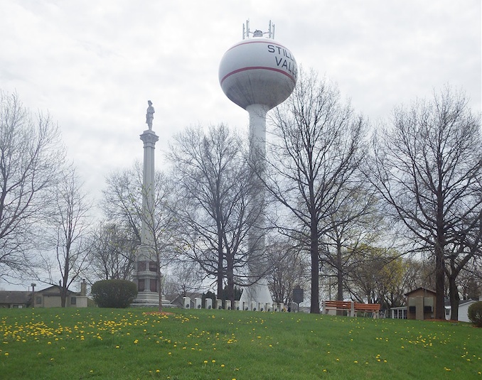
In spring of 2016, NIFS staff completed a Phase I survey of a temporary construction easement along Illinois Route 72 in Stillman Valley, Ogle County. The easement crosses the northwest corner of Battle Ground Monument Park, which contains the National Register of Historic Places listed monument memorializing the Battle of Stillman’s Run. The Park contains the common grave for twelve militiamen killed by Black Hawk and his warriors during the 1832 Battle of Stillman’s Run, understood to be the first engagement of the Black Hawk War.
The monument reads, in part, “In memory of the Illinois volunteers who fell at Stillman’s Run, May 15, 1832…The presence of the Soldier, Statesman, Martyr Abraham Lincoln assisting in the burial of these honored dead has made this spot more sacred." While the Park holds much history, NIFS found no cultural material within the survey area and project clearance for IDOT work within the restricted temporary easement was recommended.
Posted on 14 November 2016.
Return to top
Return of the Alexander Robinson Tombstones and Identification of the Robinson Cemetery Boundaries
(FPDCC Log No. 39; ISAS Log No. not available), funded by FPDCC
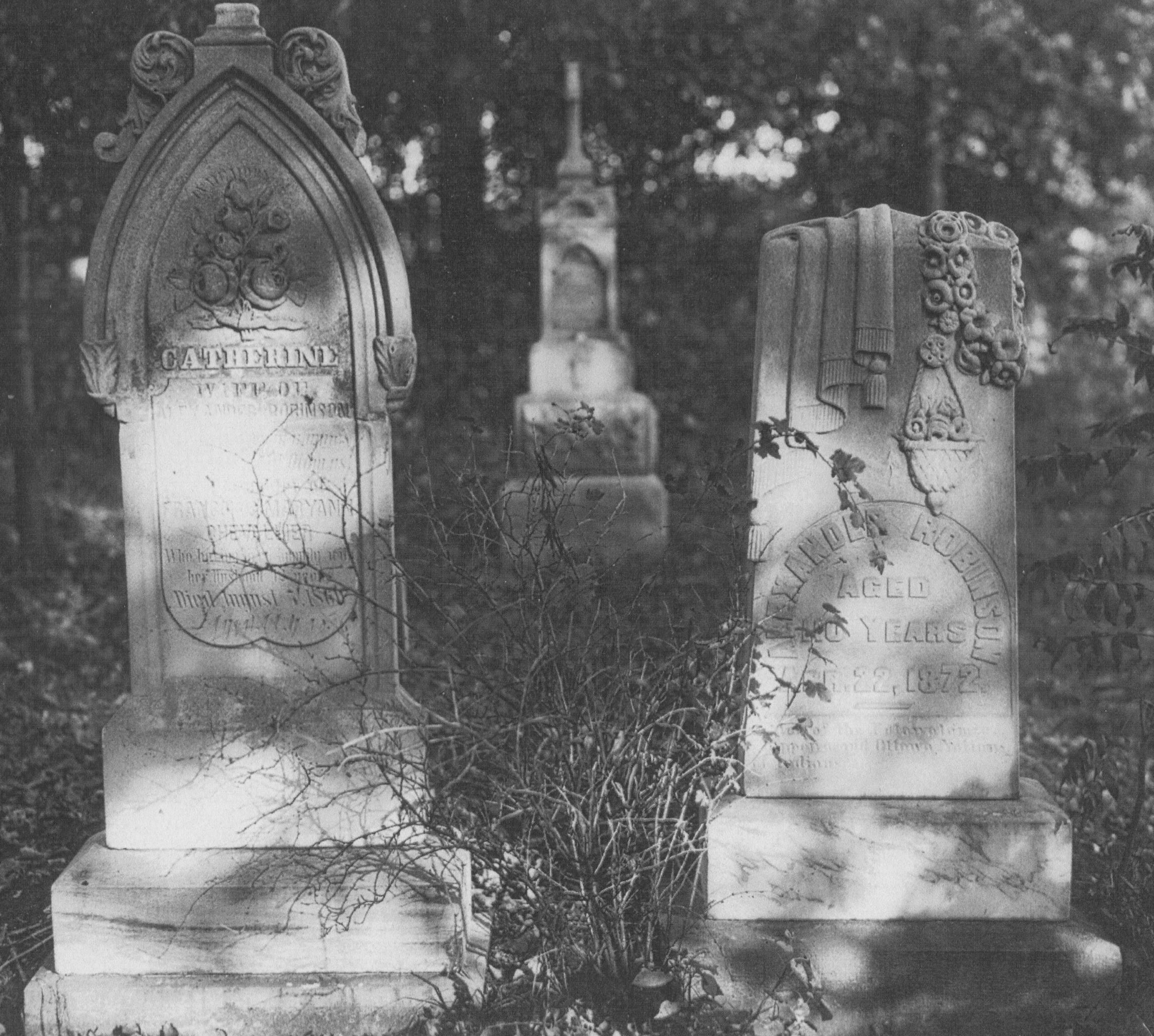
Site 11CK630, located in Catherine Chevalier Woods within the Forest Preserve District of Cook County (FPDCC), contains the burials of Alexander Robinson (Chief Che-Che-Pin-Qua) (d. 1872), his second wife Catherine Chevalier (d. 1860), and at least 9 descendants. The earliest interment date is 1841, with Mary (Robinson) Rager listed as the last interment in 1927. Ownership of the cemetery passed from the Robinson family to the FPDCC in 1920. Frequent vandalism of the cemetery throughout the following decades prompted the FPDCC to remove the remaining tombstones and tombstone fragments to a nearby FPDCC warehouse for safe-keeping in 1946. Later that year, a large boulder and commemorative plaque were placed in the general vicinity of the otherwise unmarked cemetery. Unfortunately, in the years that followed, knowledge of the location of both the tombstones and the exact cemetery boundaries was lost.
In 2014, FPDCC staff notified NIFS that many of the tombstones and tombstone fragments had been relocated. NIFS staff recorded and transferred the tombstones to the Illinois State Museum for temporary storage, and in 2015 facilitated their official transfer back to the descendants of Chief Che-Che-Pin-Qua. In 2016, ISAS staff conducted a geophysical survey in Chevalier Woods, successfully relocating the original cemetery boundaries and allowing FPDCC land managers to protect the cemetery from any future ground disturbance or planned development.
Posted on 14 November 2016.
Return to top
Quad Cities International Airport
(Project: Quad Cities International Airport (IDOT Seq. No. 18930, ISAS Log No. 14155), District 2, funded by IDOT)
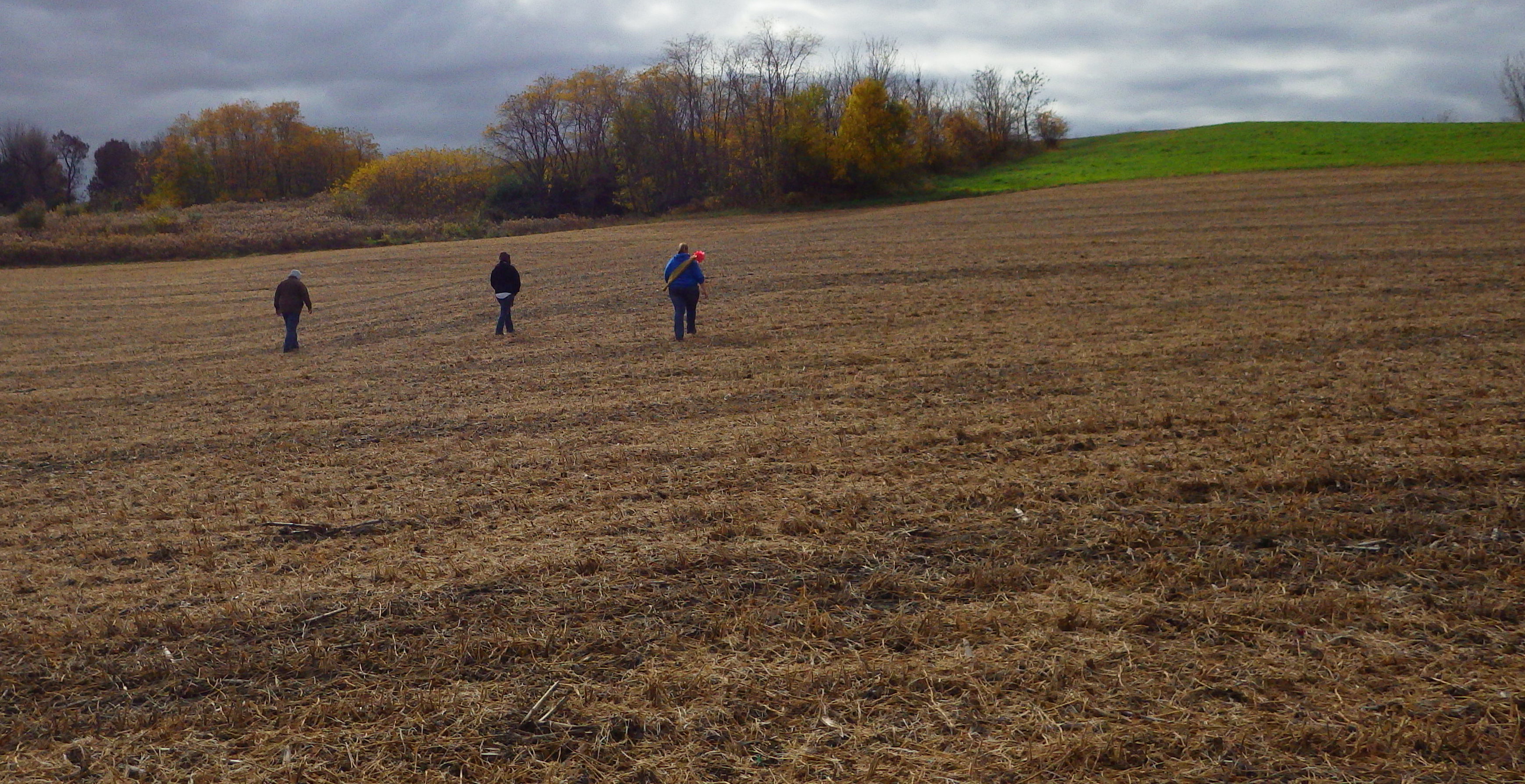 In the spring of 2015, NIFS archaeologists and crews surveyed almost 250 acres in and near the Quad Cities International Airport in Rock Island, Illinois. The airfield is located on the south side of the Rock River valley, about seven miles from the confluence of the Rock River and the Mississippi River. Both the airfield and its environs are made up of terraces and floodplains with many bluffs rising along the airport's south side. Our archaeologists discovered five new sites--two of which were prehistoric and of particular interest--Site 11RI94 and Site 11RI411. We were also able to revisit nine sites previously recorded in the survey area.
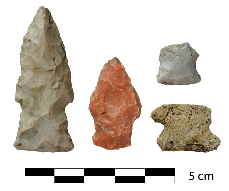
Site 11RI94 spans a sandy ridge situated within the Rock River floodplain. Originally recorded in 1961, this site has produced Archaic period tools including a Hardin Barbed point, a Dovetail point, and a Blacksand point. A late Paleoindian period Dalton point was also found on this ridge. Additional prehistoric artifacts found include tool fragments, grinding stone fragments, a broken axe, hafted scrapers, a quartzite blade, non-diagnostic projectile points, flakes, and cores.
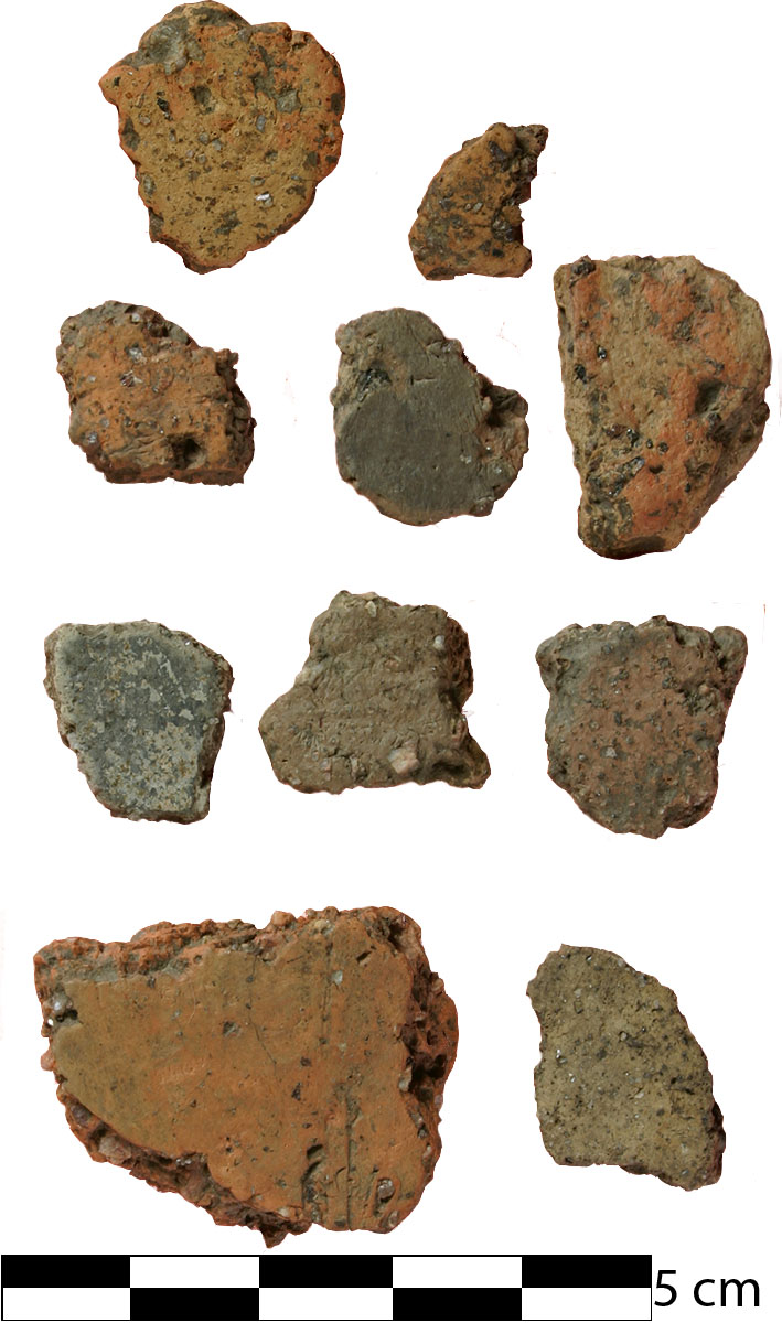 Site 11RI411 is a Middle Woodland period site originally recorded in 1976. At that time surface collection from the site collection yielded lithic debitage, a few blades, a broken celt, and grit-tempered ceramics, including some rim sherds. The NIFS 2015 survey extended the site boundaries to include three adjacent sites and as a result found almost 500 additional artifacts including three Lowe points (Terminal Middle Woodland-Early Late Woodland), one Jack’s Reef point (Late Middle Woodland-Late Woodland), and 26 prehistoric ceramic body sherds, all of which have grit temper and no exterior decoration or cordmarking (general Woodland).
Return to top
Commonwealth Edison Bike Trail
(Project: Commonwealth Edison Bike Trail (IDOT Seq. No. 19352, ISAS Log No. 15088), District 1, funded by IDOT)
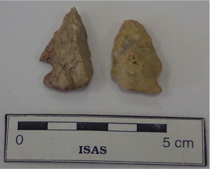
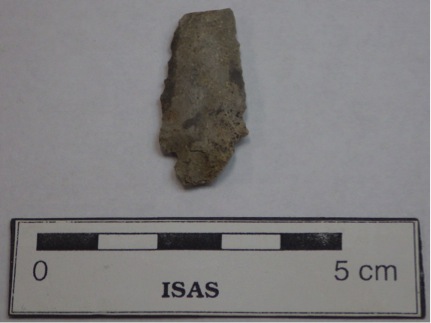
NIFS archaeologists and crew surveyed a proposed three-mile long pedestrian and bike trail located near Romeoville in Will County. The Commonwealth Edison Bike Trail will pass several upland wetland areas that lie between Mink and Lily Creeks, resource-rich environments that were commonly used by the Archaic peoples who once inhabited northern Illinois. Our investigations identified two new prehistoric sites, as well as two previously known prehistoric sites, all situated near wetland resources. Our archaeologists recovered a number of diagnostic artifacts from three of the sites including bifaces/knives, projectile points, scrapers, an abrader, a spokeshave, a perforator, and utilized flakes—all of which strongly indicate that this area was intermittently but continually used during the Early, Middle, and Late Archaic periods. We also observed that the landform the proposed trail will be located on has been only minimally disturbed by cultivation. This means there is a real possibility that three of the four prehistoric sites we identified and investigated may contain well-preserved subsurface deposits--deposits which may contain information about these Archaic people's subsistence practices. The Illinois State Archaeological Survey (ISAS) recommended that the sites be placed on the National Register of Historic Places (NRHP) and that the path be redesigned to minimize disturbance to the sites, helping to preserve these and other cultural resources in northern Illinois.
Return to top
Roe's Hill
(Project: West Ridge Nature Preserve Pedestrian Trail and Landscape Restoration (IDOT Seq. No. 17501, ISAS Log# 12196), District 1, funded by IDOT)
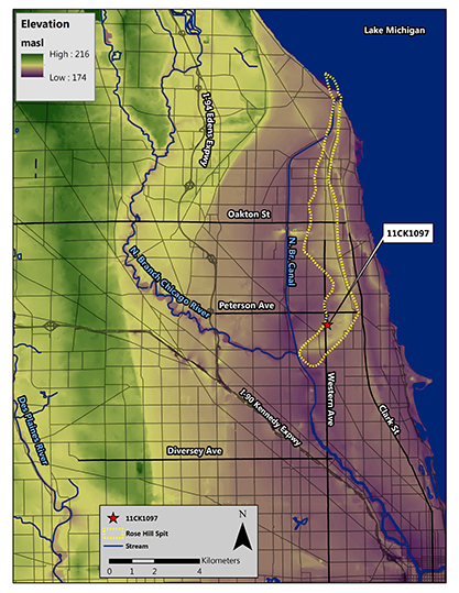 NIFS completed survey and test excavations within the Chicago Park District’s West Ridge Nature Preserve, immediately adjacent to Rose Hill Cemetery. One new prehistoric site (Roe’s Hill) located within the Preserve, and eligible for listing on the National Register of Historic Places, contains information about some of Chicago’s earliest inhabitants as well as information about changes to Chicago’s Lake Michigan shoreline.
The neighborhood containing the site was originally named “Roe’s Hill” in reference to pioneer and moonshiner, Hiram Roe, who sold his spirits from a cabin in what was then the village of Bowmanville—now Edgewater. Bowmanville was named after a nefarious land speculator who came to the area in 1850, bought a large tract of land, platted the tract, then jilted his clients of their down payments on their parcels, and skipped town. Roe’s Hill was later changed to Rose Hill as a way to soften the image of the area. The archaeological site name pays homage to the original neighborhood name, bearing a different spelling than that of the adjacent Rose Hill Cemetery and that of the ancient glacial beach remnant identified as Rose Hill Spit.
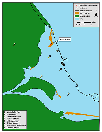 The Roe’s Hill site lies in close physical proximity to, and probable close cultural affiliation with, the historically documented Indian village identified by Albert Scharf in 1901 and later studied by Fenner in 1961. The site also sits on the 11,000 year old Rose Hill Spit. This unique landform supported a diverse array of plants and animals creating attractive settlement areas for native populations.
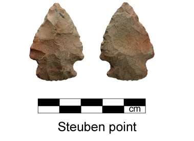 The site was identified by NIFS during shovel testing of a 21-acre wooded parcel. Phase I archaeological investigations produced over 450 prehistoric artifacts including a Stueben Corner Notched projectile point (Middle to Late Woodland), biface fragments, a point tip, flakes, shatter, tested chert, fire-cracked rocks, and charcoal. Phase II archaeological testing included machine stripping of ten excavation blocks within a narrow walking path proposed within the Preserve. The portion of the Roe's Hill site immediately affected by the walking path did not contain intact subsurface archaeological materials. However, the site as a whole may be eligible for listing on the National Register of Historic Places due to its likely connection with the historically documented Indian village identified by Scharf, as well as its potential to contain information about the early human occupation and use of Rose Hill Spit.
Return to top
US Route 30 Study
(Project: FAP 349/US Route 30—Baseline Rd., Addendum A (IDOT Seq. No. 17659A, ISAS Log# 14128), Districts 1 & 3, funded by IDOT)
In the Summer of 2015, NIFS archaeologists and field crews completed a cultural resources survey along US Route 30, west of the Fox River at the Kane/Kendall county line in preparation for roadway improvements in the City of Montgomery. Although most of the survey area was already developed with private homes and commercial properties, our archaeologists were able to revisit one previously known site, and discovered six new archaeological sites. Two of these sites, the historic Jacob Keck Memorial Cemetery and a prehistoric site (11K1374) with evidence of extensive stone tool manufacturing activity, may be eligible for listing on the National Register of Historic places.
The Jacob Keck Memorial Cemetery holds 179 burials dating from 1836 to 1936. Many of the graves belong to the extended Keck family. Local history states that Jacob Keck, with his wife Nancy and their eleven children, arrived in the area in 1841. Soon after, on October 23, 1841, Mrs. Keck died and was buried in the cemetery. Although already in use, the cemetery was not dedicated until two years later on September 19th, 1843. Local history also reveals that almost a decade later, in January of 1853, Jacob Keck set aside a parcel of land next to the cemetery on which a combination school and church building was built. Unfortunately that building burned down, but in 1873 a new building was constructed and maps show that a school has stood near the Keck Cemetery for more than one hundred years, until as recently as 1986.
The second site NIFS archaeologists and field crew located, prehistoric site 11K1374, contains chipping debris from all stages of stone tool manufacture. The site is located on a rise next to a wetland, which was an ideal place for Native Americans to hunt large birds, fish, and other animals as well as gather plant resources used for both food and shelter. And, although the prehistoric site has been subjected to a great deal of flooding and erosion, it appears to have remained relatively undisturbed, and it is very possible that portions of the site still remain preserved under some of these flood deposits.
Return to top
Bliss Road Realignment
(Project: FAP 520 Bliss Rd. Realignment (IDOT Seq. No. 19105, ISAS Log# 15002), District 1, funded by IDOT)
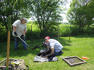 Also during the Summer of 2015, NIFS archaeologists and field crews completed a cultural resources survey of nearly 300 acres in preparation for intersection and road improvements along Main Street, Fabyan Parkway, and Bliss Road in Batavia, locating four prehistoric and six historic sites.
The prehistoric sites include two small campsites near Lake Run Tributary, as well as two separate locations where NIFS archaeologists excavated projectile points dating to the Early Archaic period—including the Kanawha Stemmed point pictured below and dating between 6200–5800 B.C.
The six historic sites include farmsteads with long occupations, beginning in the mid 19th century and continuing through at least the mid 20th century. One of these historic sites, at the corner of Bliss Road and Main Street, actually began as a rural schoolhouse sometime around 1870, but by 1920 had been converted to a residence. The earliest historic site found during our survey was first occupied around 1840, possibly by the Thurston Wood family. Archaeological investigations of this site appear to indicate that, while this farmstead was in use well into the 1930s, there may still be portions of the original homestead preserved somewhere on this parcel.
Return to top
Willow Creek Bike Trail Project
Project: Willow Creek Bike Trail Project (IDOT Sequence No. 18795, ISAS Log# 14120), District 2, funded by IDOT
As part of the Willow Creek Bike Trail Project, NIFS archaeologists completed a cultural resources survey along the south bank of Willow Creek in Rock Cut State Park. Our archaeologists located a Frontier Era (1841–1870) site replete with cultural artifacts including ceramics dating from the Early to mid 19th century. The recovered ceramics had a host of decoration types including sponge (1840–1866), shell edge (1840–1860), hand painted floral (1830–1860), annular/banded (1830–1850), and transfer printed treatments in flow black (1844–1860), brown (1830–1850), and red (1829–1850). Additionally, a brick/sandstone lens was found in one shovel test, which may represent the remains of a building foundation.
Historic research indicates that James Haven, a native of Vermont and an early settler of the Rockford area, originally purchased the Willow Creek site in 1841. Haven came to Illinois between 1837 and 1839 but was living in Allamakkee County, Iowa by 1854. The Haven family likely lived on the Willow Creek parcel for 13–17 years (1837–1854). If subsurface deposits or features remain intact in this area, the site may contain information important to an understanding of one of the Rockford area's earliest Euroamerican settlements. Since the site may be eligible for listing on the National Register of Historic Places, project engineers have revised the bike path corridor to preserve the site area.
Return to top
11JD776, 11JD777, 11JD778
During the summer of 2013, the Northern Illinois Field Station of ISAS conducted Phase II testing at sites 11JD776, 11JD777 and 11JD778. These sites represent a unique historical habitation located in the unglaciated interior of Jo Daviess County, Illinois. This homestead was built and occupied by the extended Avery Family from 1827 until the late 1890s. While the Averys occupied the area, they saw the economy change from a lead-mining to an agricultural base. They homesteaded and farmed; operated a mineral and livestock scale, tavern, inn and post office; served in the Black Hawk and Civil Wars; and held civic offices. Part of the family eventually moved to Galena where the Avery Mansion is now a local landmark.
Traders who came to the area after the War of 1812 learned of lead deposits from the local Meskwaki miners. In 1822, the United States government granted a lease to Col. James Johnson of Kentucky to mine lead. This was the start of the United States’ first mineral rush. Within a few years, mines pitted the landscape and smelting cleared the land of its groves and forests. People came the area to be part of this new wealth: mining, smelting, working on the Mississippi River, or opening businesses to serve the growing population. Towns like Galena grew up as a result of this burgeoning population. The economy stayed rooted in mining until the 1840s when the price of lead drastically fell. With the collapse of the mining industry, the economy turned to agriculture.
Elias Packer Avery staked a claim in 1827, during the early days of the lead rush. His sons followed and made claims nearby the following year. The family first made themselves known in the area by enlisting to fight in the Black Hawk War of 1832. The 1842 General Land Office map shows Avery’s Field, which is most likely Elias’ original claim and Avery’s Beam, a large scale for weighing lead and livestock, advantageously situated on one of the main roads between Galena and settlements to the southeast.
Elias’ son William purchased the property in 1847. It is possible that the family had already moved from the original location as local historian and architectural consultant Daryl Watson has dated one of the extant barns to the early 1830s. The property contained a large house that was used as a stagecoach stop, tavern, inn, and post office. William also built the first area schoolhouse on the property, which doubled as a church. William became the first local postmaster, and when the township was established, he became the first tax collector. William’s house and outbuildings are recorded as site 11JD777.
One of William’s sons, George, served as a major in the Civil War. During the war he carried on a spirited debate via letters with his wife about whether abolition or preserving the Union was more important. These letters survived and are a wealth of information on political ideas of the time. When George returned from the war, he and his family moved into his parents’ house, and his parents moved to the brick house across the road, possibly 11JD778. By 1872, William owned over 600 acres containing five houses and the post office. Site 11JD776 is a non-domestic structure located south of 11JD777 and 11JD778. It may have been used as the post office and later as an outbuilding for the farmstead.
After his death in 1878, all of William’s property was split between his sons George and Cyrus. George, however, had already moved to Galena where he worked as the clerk for the circuit court, was on the school board, and became postmaster. The Avery Mansion in Galena is named after his family.
In the late 1890s, George sold his property to Augustus Berlage. The house was torn down in 1960 and its foundation ripped out; however, several of the outbuildings were left standing.
Archaeological investigations were conducted at 11JD776 and 11JD778 in the summer of 2013. Machine scraping at 11JD776 revealed the foundation of a non-domestic structure and a dump pile, both dating from the late nineteenth to early twentieth centuries. Machine scraping at 11MD778 revealed 40 features including a dry-laid limestone foundation and stone well, two privies, a juvenile horse burial, and a series of post molds. The features were sampled, yielding mid-nineteenth to early twentieth century materials. The site may represent a smaller secondary home for the extended Avery family.
Archaeological and documentary investigations for these three sites has helped shed light on early homesteading, business and community life in rural Jo Daviess County and given a glimpse into one family’s pivotal role in the fledgling economic and civic structure of this portion of northwestern Illinois.
Return to top
11CK284
The Joe Louis site sits on a high terrace above the Little Calumet River, within the Forest Preserve District of Cook County (FPDCC). Originally identified and tested by Ed Lace, former naturalist and archaeologist for the FPDCC, this site represents a substantial Upper Mississippian Fisher phase occupation with associated radiocarbon dates of A.D. 1020–1265. ISAS excavated a small portion of this large village site in 2011 as part of a bike trail project along the Cal-Sag Canal. Excavations revealed a densely occupied area with more than 100 prehistoric features, including many small to medium and a few large-sized pits containing refuse from the Native American village, as well as a large trench that extended across the top of the terrace. Further investigation did not clarify whether this trench was a result of Native American occupation of the site (i.e., a defensive ditch) or whether it was from modern use of the site area.
Village refuse recovered from the pit features consisted of broken pottery typical of the late Fisher phase, stone tools and stone tool production debris, copper beads and fragments, animal bone, and charred seeds, nuts, and other plant material. Most of the pottery was decorated with trailed lines, punctates, lip notching, and handles or other appendages, and some show similarities with pottery from the same time period recovered from Indiana. Stone tools consisted largely of small triangular projectile points (i.e., Madison points), drills, small scrapers for working hide, and knives. Some of the raw material for making these stone tools could be found locally; however, a good deal of the lithic material linked Joe Louis with western and southwestern Indiana, western Illinois, and even central Wisconsin.
Animal bone consisted largely of white-tailed deer, a locally available and important food resource. A number of bison and elk scapula hoes were found, indicating people were involved in agricultural pursuits at the site. Importantly, larger meat-bearing elements of bison were also recovered, suggesting local hunting rather than long-distance trade. Riverine resources were heavily utilized as well, including fish, waterfowl, turtle, muskrat, and shellfish. A seemingly disproportionate number of bird wing bones were recovered from the site, suggesting perhaps wing feathers were being harvested for making fans or other ceremonial garb. Bone tools include beamers (used for hide processing), antler tine pressure flakers (for making stone tools), and bone needles.Personal ornaments of bone, tooth, shell, and copper were recovered as well.
Plant remains include corn, squash, tobacco, and a small amount of bean, in addition to native cultigens such as chenopodium and little barley. Fairly significant amounts of wild rice were recovered from one portion of the site as well, indicating people were not only farming, but harvesting locally available plant resources. The floral and faunal remains from the site suggest that Joe Louis was occupied year round.Given the evidence for extra-regional interaction, Joe Louis may have been a gateway site, located on an important transportation route around the southern end of Lake Michigan.
ISAS Log#10165, IDOT Sequence #16072.
Return to top
11L730
11L730 was located during phase I survey for CH20 Peterson Road improvements. Situated in central Lake County, 11L730 is a small, mid-19th century farmstead associated with the Bartle family, ca. 1845–1875. The site includes a small subfloor cellar, an exterior "keyhole" cellar, and a well. To date, ITARP has investigated few mid-19th century farmsteads in northeastern Illinois. 11L730 provides a good sample of a conservative, antebellum/war-era farmstead. Analysis of excavated materials is ongoing.
Return to top
Dutcher I, II, and III (11LE72, 11LE73, and 11LE74)
11LE72, 11LE73, and 11LE74 were identified during the Phase I survey for FAS 1184, the Rockyford Road bridge replacement over the Green River with intersection improvements at River View and Newman Roads near Amboy in Lee County.
Dutcher I, II, and III sites are each associated within the mid-19th century commercial hamlets of Rockyford and Shelburn. Located near the road from Dixon to Peru recorded on the 1843 GLO, the Dutcher sites are affiliated with two eras of occupation.
The earliest component is the ca. 1835–45 "Perkins Mill" era, related to domestic and commercial activities associated with a sawmill on the Green River. Included in this component are at least one residence and a short-term blacksmith shop. The blacksmith shop has been excavated in its entirety and has produced a large sample of forged iron debris.
The second component, affiliated with the platted communities of Rockyford and Shelburn (ca 1845–1870), has thus far produced several large features that contain artifacts that appear to relate to both domestic and commercial contexts. The features themselves include three sub-floor probable residential cellars, a fourth very large sub-floor cellar likely associated with commercial activities, animal processing pits, a cistern, four privies, several fence lines, and various other features of unknown function. The mid-century materials from these features include a range of refined ceramics, regionally made stonewares, alcohol and tumbler glass, and kaolin pipe bowl and stem fragments. The large sub-floor cellar contained numerous Bristol-marked beer bottles and wine bottles with intact stoppers. The cistern has produced a number of large vessel sections, buttons, and a unique pipe fragment. An additional area has produced blacksmithing material ranging from large hand-forged tools and hardware to small pieces of blacksmithing scrap and large amounts of clinkers. Excavation and analysis of the sites is currently in progress.
Return to top
11WI3037 and 11WI897
11WI3037 and 11WI897 were identified during Phase I survey for the extension of 95th Street from Naperville/Plainfield to Boughton Road in Will County, Illinois. 11WI3037 is 0.52 acres in size and is located on a broad terrace 50 meters north of the DuPage River. During initial shovel testing of 11WI3037, grit-tempered ceramics and various tools and chert debitage were recovered. The ceramics were severely eroded; consequently the decoration and surface treatment were not distinguishable. The overall artifact assemblage is indicative of a Woodland/Mississippian temporal affiliation. Hand units excavated within 11WI3037 identified an additional Late Archaic component based on recovery of Matanzas and Trimble/Riverton point.
11WI897 is located within a fallow field on a low terrace 45 meters north of the DuPage River. Previous surveys have produced diagnostics from the Early, Middle, and Late Archaic periods. During the initial survey by ITARP for the of 95th Street extension, 11WI897 increased in size from .66 to 2.28 acres. Addition material recovered by ITARP during a controlled surface collection consists of chert debitage, chert and groundstone tools, and FCR. No additional diagnostic material was recovered at this time. Further investigations of these sites may follow in the upcoming field seasons.
Return to top
Crosstown Avenue site (11RI693)
The Crosstown Avenue site is located between Silvis and Carbon Cliff on flat uplands at the edge of a small intermittent stream that drains into the Rock River approximately 2 km to the east. Testing produced a single Late Archaic cluster comprised of 24 pit features, with diagnostic artifacts similar to Sedalia and Nebo Hill material from western Illinois (see Western Illinois Survey Division Current Research). The Crosstown Avenue site is the oldest and most northern Late Archaic site in Illinois with a Titterington-like tool assemblage to produce radiocarbon dates. Three features produced radiocarbon dates (cal. 2470 B.C. and cal. 2560, 2540, 2500 B.C.) that fall at the later end of dates produced from other Titterington-age sites (e.g. Billboard Flats, Ursa Major, Hayden, Penstone, George Reeves).
A total of 7739 pieces of flaking debris weighing 5502.6 g was recovered during feature, test unit, and block excavation. Eighty-five percent of the debitage was recovered from feature contexts; however, only 43% by weight was recovered in features. Also recovered were more than 2357 pieces of igneous/metamorphic fire-cracked rock, 769 pieces of burnt sandstone, 11 pieces of burnt limestone, 126 pieces of burnt clay, 789 unburnt igneous/metamorphic, sandstone and limestone rocks, 51 small pieces of hematite, and 14 small pieces of limonite. The tool assemblage consists of eight Sedalia/Nebo Hill point fragments, four Sedalia/Nebo Hill preforms/knives, one bi-pointed knife, four drill fragments, 11 wedges, 18 biface/biface fragments, one formal scraper/perforator made on a flake, and 127 intentionally modified flakes. Eight groundstone tools were recovered, consisting of two sandstone abraders, two manos, one abrader/mano, one axe bit, and two hammerstones. Twenty-five of 47 formal tools were recovered from feature contexts; fifteen were from three features yielding radiocarbon assays.
Return to top
Glacier Shadow Pass Survey
Previous investigations of 11OG234 along the Rock River floodplain were comprised of pedestrian survey and minimal oakfield coring. One hafted biface temporally affiliated with the Early/Middle Archaic was previously located during pedestrian survey. Given the close proximity to a large mound group and the high probability for intact subsurface features based on the presence of diagnostic material and a large quantity of chert debitage, backhoe trenching within the site area was undertaken for the proposed realignment of IL2. Our subsequent investigations revealed two Early Archaic pit features and an intact living surface.
Return to top
11OG234
Previous investigations of 11OG234 along the Rock River floodplain were comprised of pedestrian survey and minimal oakfield coring. One hafted biface temporally affiliated with the Early/Middle Archaic was previously located during pedestrian survey. Given the close proximity to a large mound group and the high probability for intact subsurface features based on the presence of diagnostic material and a large quantity of chert debitage, backhoe trenching within the site area was undertaken for the proposed realignment of IL2. Our subsequent investigations revealed two Early Archaic pit features and an intact living surface.
The Early Archaic living surface, located approximately 40 to 50 cm below ground surface within a 3.5 x 4.5 m area, was identified by the presence of high concentrations of chert debitage (n=1047) and two Early Archaic Kirk Corner-notched points. Dense chert debitage concentrations were noted during excavation and may represent discrete activity areas resulting from a single depositional episode. Three broken bifaces of the most ubiquitous chert were also located during shovel skimming.
Unfortunately, no carbonized botanicals to date have been recovered from flotation samples to submit for radiocarbon dating. Dated Kirk horizons, as well as other dated Early Archaic sites, are absent from northern Illinois. Other Kirk Horizons from sites in the Midwestern and Southeastern United States have produced radiocarbon dates from 9450 to 8600 B.P. uncorrected, and is likely the approximate age range for 11OG234.
Return to top
11WT216
An archaeological survey for the FAU 5548 (Lynn Blvd) extension for IDOT was undertaken by ITARP in the summer of 1988. Surface collections on a previously recorded multi-component site — 11WT216 — indicated a Middle to Late Archaic concentration of materials in the western half of the site and Upper Mississippian (Langford) materials throughout the eastern portion. The site is located on a west-facing terrace overlooking Elkhorn Creek, six meters above the floodplain. Testing of approximately 627 sq m (4%) of 11WT216 in the summer of 2003 revealed eight moderate to shallow basin features within the site boundaries. The site has been subjected to severe erosion due to farming activities on the terrace. The shallow nature of the features and the soil profiles of the excavation blocks clearly demonstrated the severity of the erosion at 11WT216.
The investigations confirmed the temporal affiliation of 11WT216. One large section of a Langford trailed globular shaped vessel was uncovered within Feature 4. The remaining features yielded sparse quantities of lithic and grit-tempered ceramic material that conform to the characteristics of the Langford tradition; however, diagnostic lithic material was not recovered from any of these features.
Return to top
Caton Farm/Bruce Road (FAU0292)
ITARP personnel have initiated field investigations for the four-lane road, bike trail, and bridge alignment in Will County. The project involves a new crossing of the Des Plaines River, Sanitary & Ship Canal, and I&M canal from U.S. 30 and Caton Farm east across the river valley to an undetermined location and north to IL 7. To date, seven alternative alignments have been designated within this 240 acre project. Pedestrian survey has been completed on all but two alignments. Two hundred acres have been surveyed and 35 sites and 29 find spots have been recorded. Seventeen of these sites are prehistoric unknown. The remaining sites are temporally affiliated with the following; one Paleoindian, three general Archaic sites, six Early Archaic sites, one Middle Woodland site, one Middle to Late Woodland site, and three Late Woodland to Mississippian sites.
Return to top